Directions
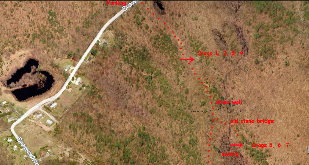
Snake Den State Park is located in Johnston off Route 6 (Hartford Ave).
It is 8.4 miles/16min from Providence. From Providence and points east follow Rte 6 west. Two miles west of Rte 295 take a
right at light on Brown Ave. After about one and a quarter miles there
is a small parking area on the right. Do not park here. Go for another
three quarters of a mile and there is second parking area on the right.
Park here. Follow the trail past a small pond (dry in summer) for a few
hundred yards. You will go down a steep hill and will see the first set
of cliffs (crags 1,2,3,4 in the guidebook) immediately on the left. To
get to crags 5,6,7 keep following the trail for a hundred or so yards.
You will see a stone wall that use to cross the road and was
dismantled. There is a trail a short ways after that on the left where
it starts to get swampy. I put a cairn there but it may or may not be
there. Follow the trail to a bunch a rocks that apparently use to be a
bridge. Cross the little brook there. The crag is visible slightly to
your right.

There are seven cliffs at Snake Den State Park which range from 15 to 35 feet in height. The rock is granite with loose rock on some of the cliffs. The routes range from 5.2 to 5.12+ with the majority of established routes being in the double digit range. Some of the hardest established routes in RI are at Snake Den. These are some of the more popular routes.
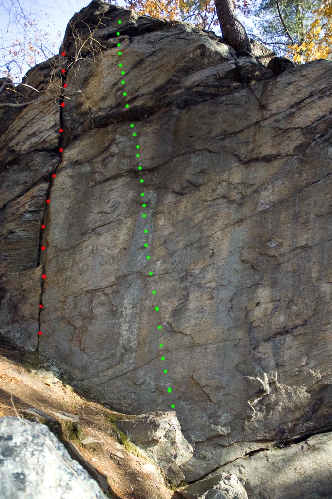
Crag 3: Red - No Name 5.8, Green - The Rattlesnake
5.12+
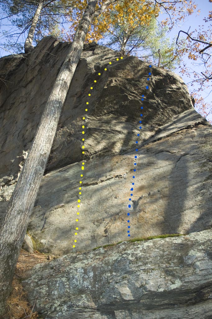
Crag 3: Yellow - No Name 5.9+, Blue - The Fang
5.10-
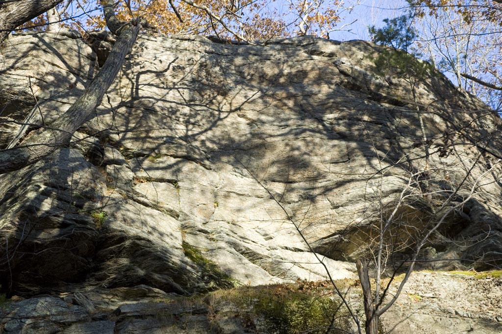
Crag 4: Various easy routes ranging from 5.4 to 5.8 on this low angle
face.
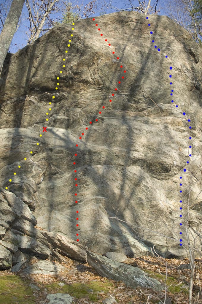
Crag 6: Yellow - No Name 5.10+, Red - Battle of
the Bulge 5.11-, Blue - Toastmaster
5.11+
There is a single bolt someone placed here. Unfinished bolting job?