Durfee Hill Management Area
Directions
Directions are from
Providence and points east so if coming from the south or west your
directions will vary. Take Route 44 west. Take a left on
Route 94 (Reynolds Road). Go for
about a mile and a half. Pass the brown sign and parking lot for the
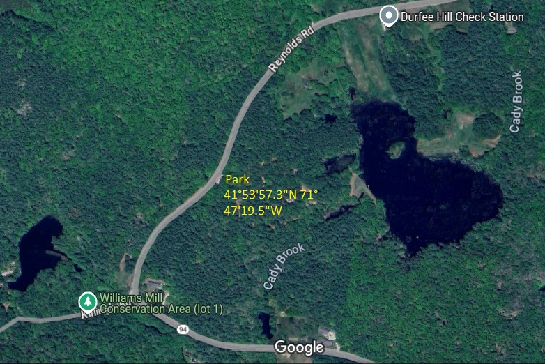
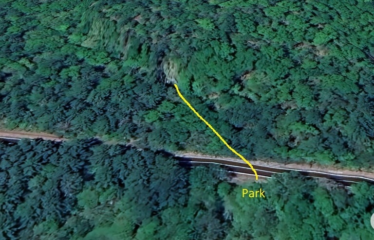
Durfee Hill Management Area. There are three parking options.
The parking area for Hemlock Ledge is the largest parking
area. There are pullouts at the Roadside Crag and the South
Crag
that will accomodate a couple of cars.
|
|
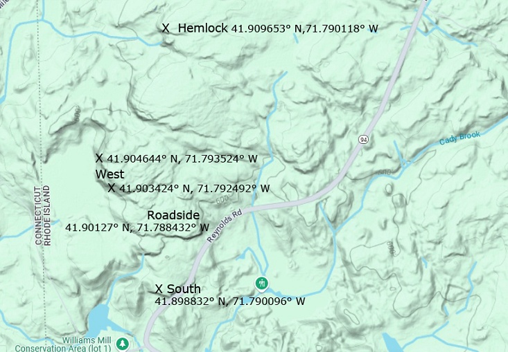 Coordinates |
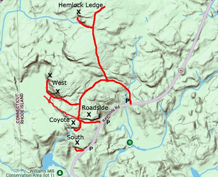 Trails |
Routes
The rock is
granite and has routes on
slabs and
vertical
and diagonal cracks. Practicing
trad leading on easy routes is possible in many of the cracks. This was
mostly a top-rope area for years but has seen a number of bolted
routes put up by an area local. First Ascent (FA) nformation is what is
known.
Sport routes were put up recently, so this route information
is known. All sport routes have drop-ins (Mussy hooks, biners)
at
the anchors. The grades here are old-school (i.e. more accurate) if you
are accustomed to gym grades. All first ascents refer to a route that
has been led
ground-up no falls or takes unless otherwise noted as a top-rope (TR)
ascent. There are four cliffs that I have arbitrarily named by their location with the
exception of Hemlock Ledge which is identified as such on USGS
topographic maps. Some of the
cliffs are a way in the woods and hard to find, especially when there
are leaves on the trees.
Roadside Crag
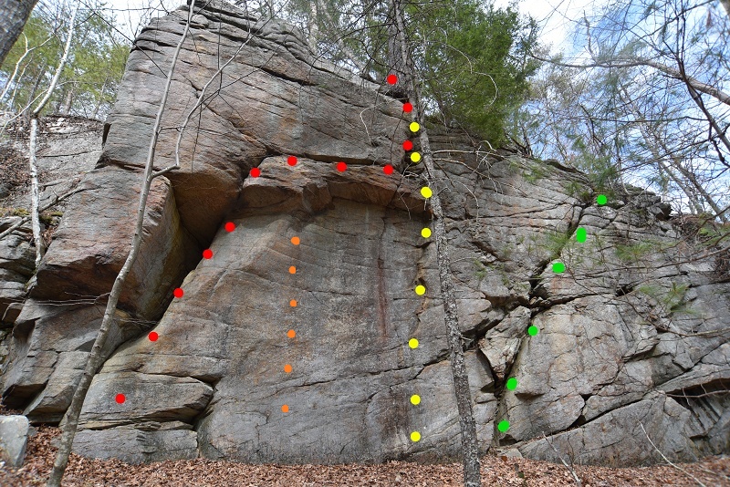 Red-Durfee Dangler 5.11a. Orange-Dangler Direct 11c. Yellow-Durfee Straight 5.7. Green-Fat Hands 5.6. |
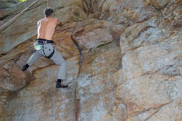 Durfee Dangler |
Roadside
Crag Durfee
Dangler 11a
FA Ward Smith 1985
Dangler Direct
11c FA Ward Smith 1985
Roadside Crag (west end)
Keep
following the cliff band from the first cliff. There are multiple
cracks here that have been led trad over the years.
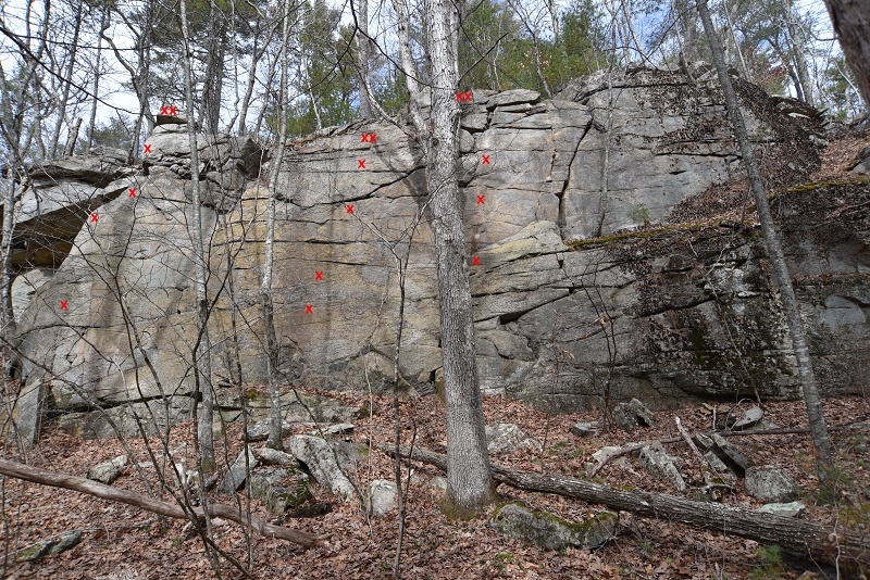
Backbreaker Arete.
5.8. Dirty Deeds 5.9.
Big Tree Route
5.8. Unamed crack 5.6. Vultures
5.8
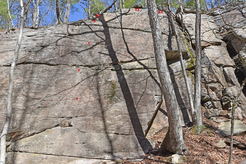 |
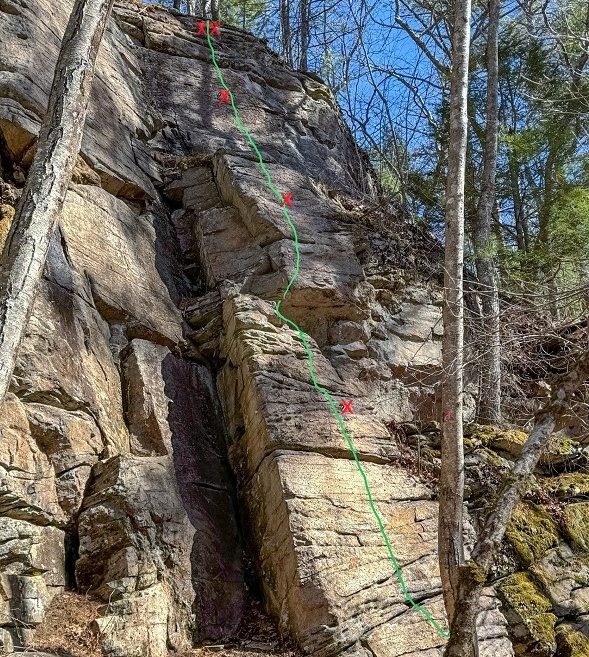 |
West Crag
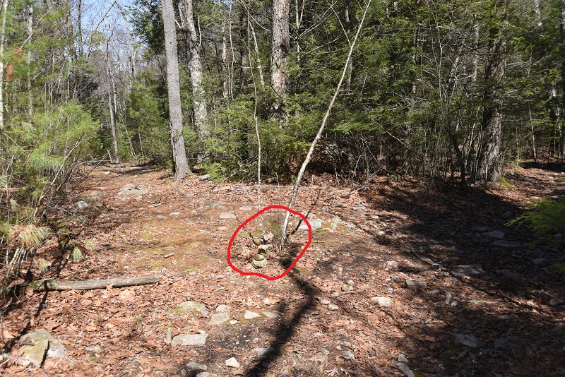
This is a bushwhack
off the trail. It is marked with a small
cairn. Follow the cliff band on a rocky hillside.
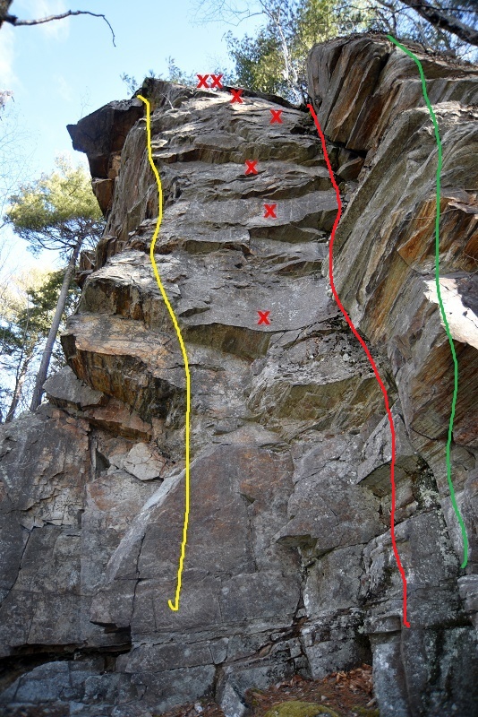
Yellow bolts-Shade Tree Mechanics 5.9. Red bolts-Overlaps 5.9+. Red-Rattletrap 5.6. Green-Unamed arete 5.9
West
Crag
Shade
Tree Mechanics
5.9. Shared first bolt with Overlaps. FA Jeff Sargeant, August 2025
Overlaps
5.9+ ** FA Jeff
Sargeant, October 2024. Climb steep rock
past four small overlaps. From the
fourth bolt, climb easier rock past two more bolts to the anchors.
Rattletrap
5.6 FA Jeff Sargeant, October 2024. Trad. Climb
the large and sometimes loose
left-facing corner to its top. From the large ledge at its top, climb
the short
face and left-facing corner above to the trees. Unamed
arete to the left of overlaps. Climb overlaps to the top.
Hemlock
Ledge
(Not to be confused with Hemlock Ledge at Beach
Pond. )
Parking: Heading south on Route 94 from the intersection with Route 44, you’ll pass a RI DEM Check Station on your left. Go downhill past the station and turn right into the next parking area This dirt lot is popular with hunters during hunting season. Be sure to wear blaze orange if visiting during hunting season.
Approach:
From the lot, follow the wide trail uphill for 0.25 miles (~ 5 minutes)
At the
top of the hill, there is a T junction, with a trail entering from the
left. At
this intersection, turn right and follow the trail uphill (north) for
about ten
minutes. The trail is rocky in places and passes through three muddy
areas. A
short distance past the third muddy area, turn left onto a trail
entering from
the left. Small cairn marks the junction. The trail
heads downhill. Near
the bottom of the hill, approximately two minutes from the junction,
there is a
large tree stump on the right, with a small cairn on top. Turn right
into the
woods here and follow a faint trail 100 feet to the base of the crag.
Total
approach time is ~20 minutes.
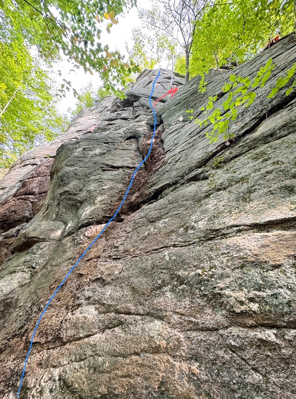
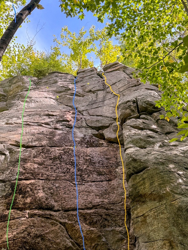 Sophie's Choice 5.7. Slippery When Wet 5.7. Sanitized 5.7 |
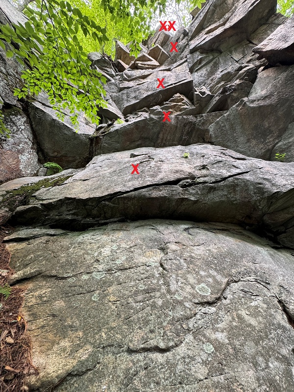
 Blue 2-Way Jack 5.6. Green-Mixed Company Finish 5.5 |
 |
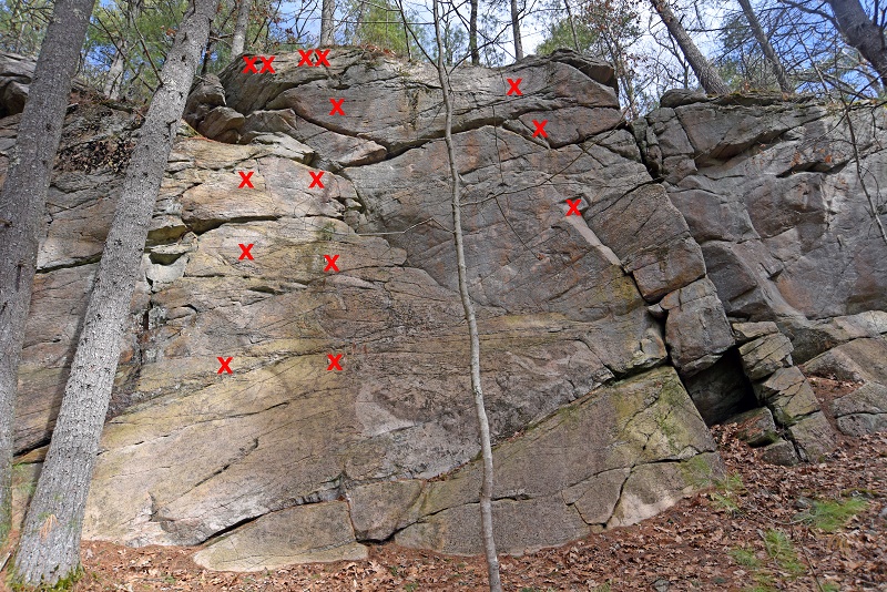 Pedestal 5.8.
Unamed 5.8.
Wet Spot
5.7. Dinosaur
5.9
|
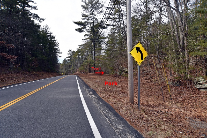 Parking for South
Crag
|